blah blah blah
Mt. Crescent
Length: 4.4 mile loopDifficulty (click for info): Hard
Elevation Gain: 1360 feet (+30 feet on descent)
Rating (click for info): 8/10
Elevation: 3256'
Prominance: 784'
Driving Directions:
Trailhead and parking area are at the end of Randolph Hill Road in Randolph, NH. From the top of the hill on Rt. 2, 3.5 miles west of the western junction with Rt. 16 in Gorham and 9.0 miles east of the junction with Rt. 115, turn north onto Randolph Hill Road. Drive 2.2 miles uphill to the end of the road. Near the end, the road turns to dirt and makes three 90-degree turns. As you approach the parking area, you will see it makes a loop around two spacious parking places. The trail takes off from the far corner of the upper lot. Click here for a Google map.
About the Hike:
The Crescent Range, a mountain grouping topping out just over 3000 feet in elevation, is named for its crescent-moon shape, stretching from Jefferson to Gorham to Berlin. The two highest peaks along the spine both bear the name Crescent, although Black Crescent Mountain, the loftiest summit in the range, is far removed from anywhere with hiking trails and thickly forested to the top. Mt. Crescent is located in the center of the long curve and is blessed with a phenomenal outlook on each side of the summit. The northern one gazes off across the expansive wilds of diverse terrain rolling up toward the Canadian border, while the southern one stands beneath the command of the towering northern Presidential peaks. The whole area is notable for hiking trails that juxtapose gentle, verdant forests, with sharp, intimidating mountainsides and jumbles of boulders. This loop hike over Mt. Crescent experiences both, but leans more toward the easier terrain.
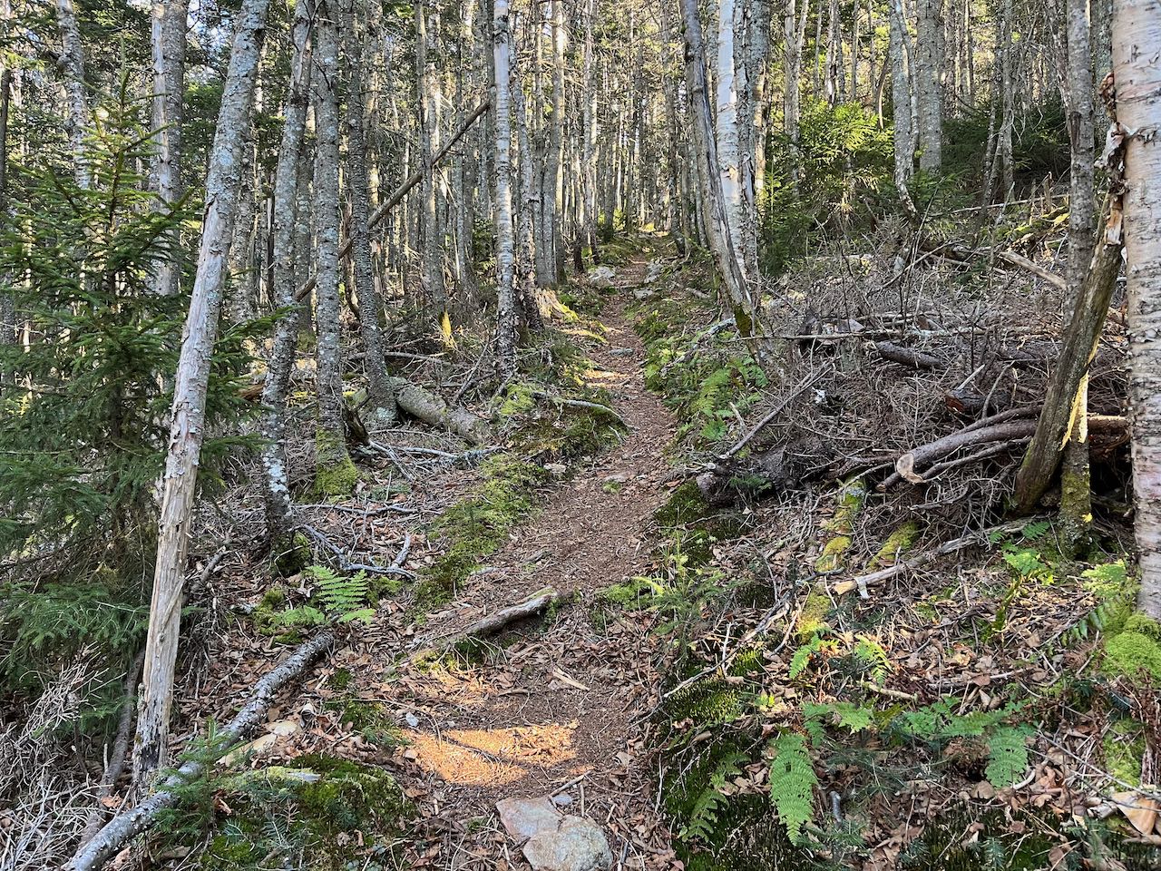
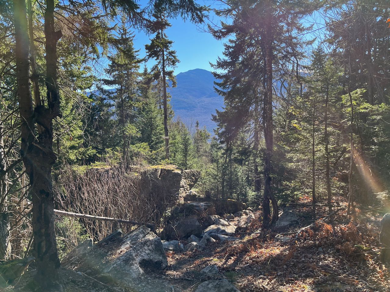
The hike begins at the RMC's community forest trailhead up on Randolph Hill, where walking and hiking trails of all characters can be found. Head to the kiosk at the upper left corner of the two-level parking area and follow the cut-through to the Jimtown logging road. Follow this intermittently used timber trail 0.15 miles to the left, to where Carlton Notch Trail crosses the road, coming in from just before the parking area. Turn right onto this trail and follow it through a tunnel of neatly-lined young tree growth. Ascend gently, following a roadbed which also doubles as a cross-country ski trail. Signs for the community forest interpretive trail are also scattered around the area. In 0.15 miles, bear left as Castleview Loop diverges to the right (where you will finish up the loop), following a fence around the edge of a small artificial pool that serves a community water system for a handful of houses on Randolph Hill. Continuing at a leisurely pace, cutting across the hillside, the wide ski corridor crosses a small stream after a quarter mile, then continues to cross the slightly bigger Carlton Brook, draining down from Cartlon Notch, in another 0.2 miles. Just after this, the hiking trail splits off from the ski trail and turns right and uphill. The ascent begins more seriously after another small stream crossing and a few flat sections. The trail zigzags uphill through increasingly rocky terrain, taking occasional breathers on flat terraces. The forest transitions to a shady evergreen environment the closer you get to the top of the ridge. After 0.8 miles, you approach level terrain on the ridgetop and tee into the Crescent Ridge Trail. Turn right at the signpost and enjoy a reprieve from the climbing as the trail crosses over a hump and dips slightly to cross Carlton Brook once again, here just below its origin from a marsh situated at the low point of Carlton Notch, the pass separating Mt. Crescent from Mt. Randolph. Signs of previous logging activity are evident, as the trail hops back and forth across open corridors filling in with low bushes. The ascent starts out gradually from the bottom of the notch. In a quarter mile, the trail crosses over a notable clearing that has mud potential, then becomes noticeably steeper. It grinds out the last couple hundred feet of climbing over the next quarter mile segment up a mossy track lined with small-diameter spruces. It levels off when it reaches the southwest end of Crescent's oval-shaped top. It takes another 0.2 miles to cross this plateau, as the trail leads through a tight passageway of trees to the trail junction near the highest point on the mountain. At this four-way junction, the trail on your right, the Mt. Crescent Trail, takes a sharp turn to lead back in nearly the same direction you came. This will be your descent route. To see the northern viewpoint, turn left and follow the path a few steps down to a clearing atop a dropoff, with a single wooden bench to take in the gorgeous vista.
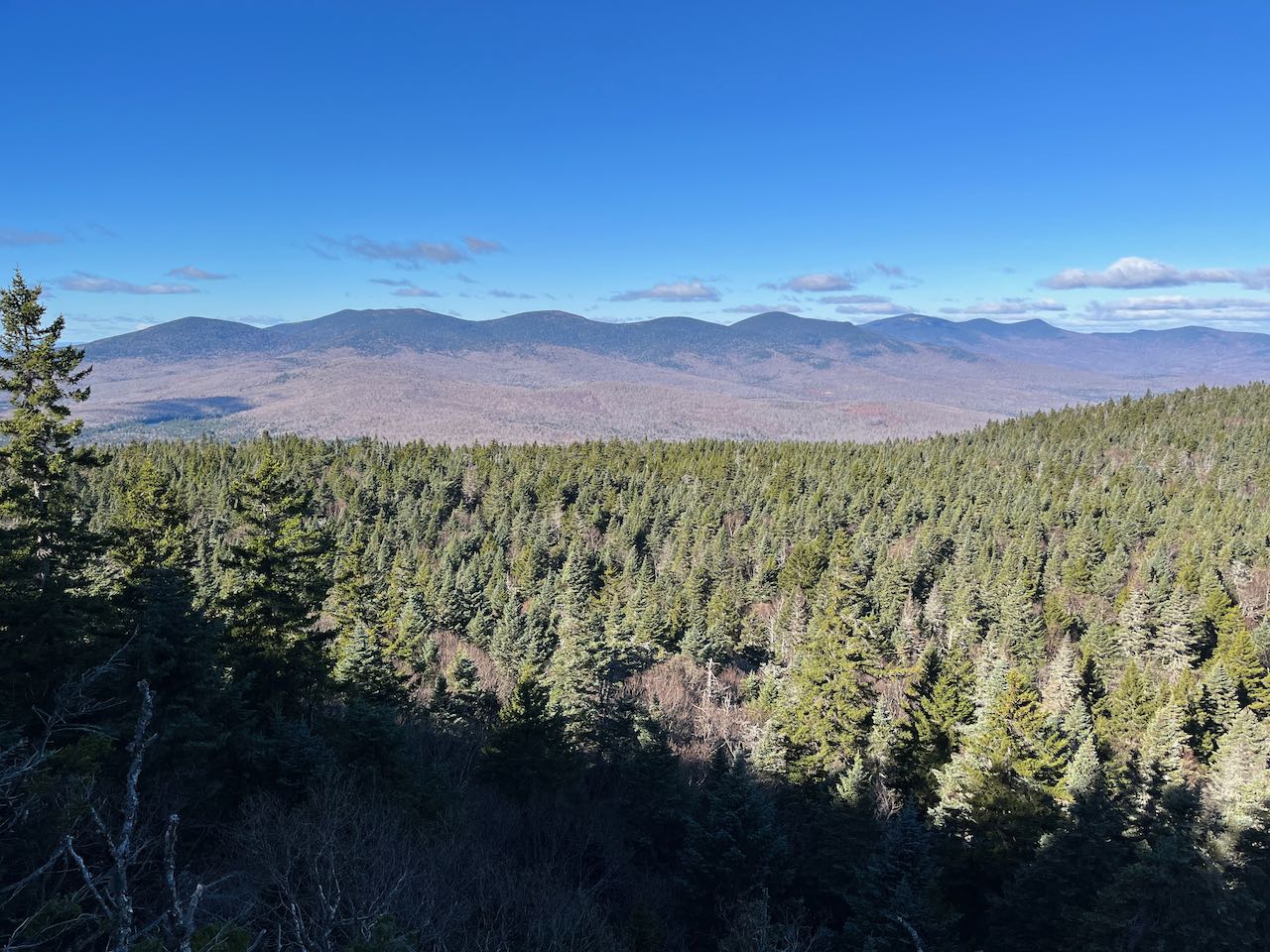
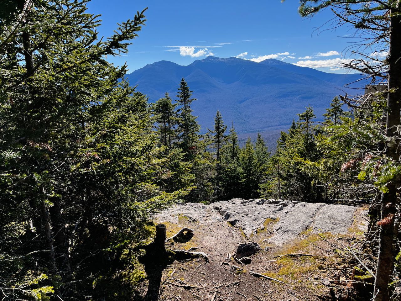
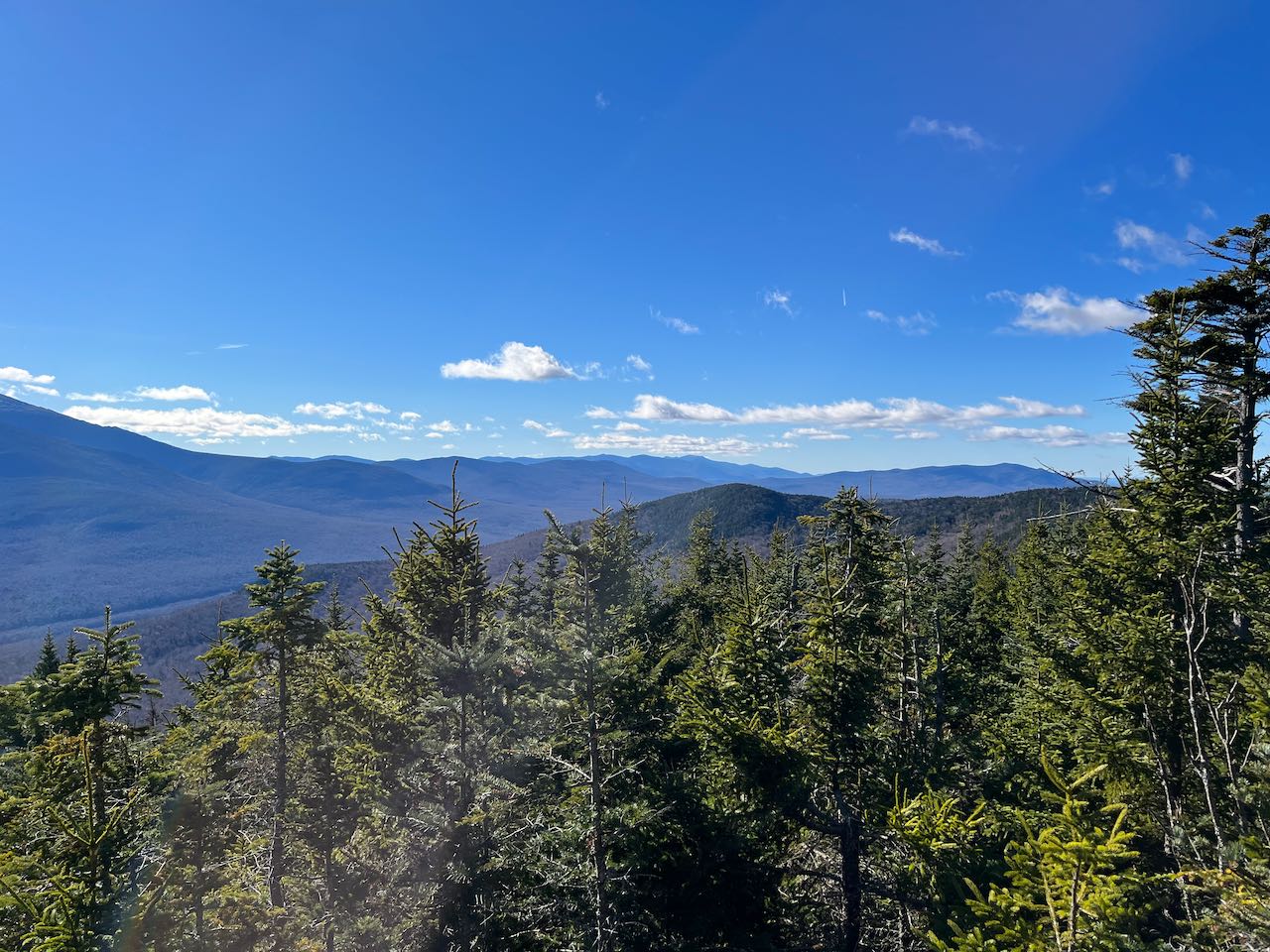
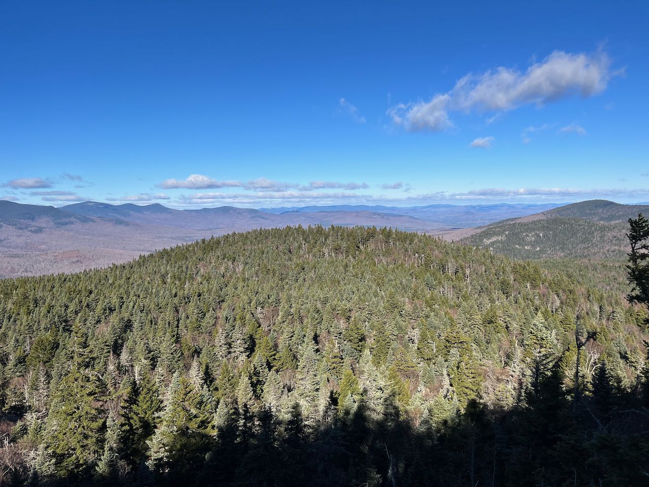
The first feature you will notice in this fine north country view is the broad bulk of Black Crescent Mountain nearby on the right. Two significant scars of cliffs and talus punctuate the mountainside. On the left side of Black Crescent, you will see in the distance the large wind farm around the Dixville Notch area, and the distant northern peaks in the Connecticut Lakes Region. Further over to the left, over the top of the knoll on Mt. Crescent right in front of you, are two long ridges - Deer Ridge below in front and Nash Stream Forest's Long Mountain behind. On the left side of these two are notable rocky peaks - Rogers Ledge at the end of Deer Ridge and the Percy Peaks further off from Long Mountain. Some of Nash Stream's taller summits are seen behind these. Next over in the panorama you see Unknown Pond Ridge, leading up to the three summits of The Horn, The Bulge, and Mt. Cabot, with Cabot's prominant talus patch on its south face. The left side of the view is occupied by the rolling summits of the Pliny Range, namely the three Mt. Weeks summits and Mt. Waumbek. Enjoy this view for a good while before heading down the Mt. Crescent Trail to the next lookout. The trail meanders across the top of the mountain, staying close by and parallel to your ascent route. It climbs briefly up the knob on the other end, then descends to reach an open ledge after 0.2 miles. There is more tree growth around this ledge, restricting the view toward the valley, but the most exciting aspect of the view is the dramatic perspective of of Presidential peaks Mt. Madison, Mt. Adams, and Mt. Jefferson (left to right). Binoculars are a boon to this striking view, where you can see into the Snyder Brook Valley and the cragged bowl of King Ravine. Off to the right, you can also see the spires of Mt. Jefferson's Castellated Ridge trailing off across Mt. Bowman into the valley. On the left side of Mt. Madison, its own bumpy Howker Ridge rolls down toward Gorham. On the left of the Presidentials, some of the Carter Range is visible, from Carter Dome on the right across South, Middle, and North Carter to ledgy Imp Mountain. On the right side is a fair view of the central Whites. The three major summits of the Willey Range poke up behind Mt. Bowman, and you see Mts. Dartmouth and Deception off to the right. Further off behind are the Twin and Franconia Ranges. Over the treetops, you can also see the southern summit of Mt. Randolph, with sprawling Cherry Mountain seen over the ridge to the right of that.
After savoring this wondrous view, continue over the edge of the outcrop, clambering down a tricky rock scramble back into the woods. The steep terrain persists for 0.4 miles, as the trail plummets down the southern slope, progressing quickly with generally good footing. At the trail junction where Crescent Ridge Trail begins, stay right to continue down the Mt. Crescent Trail. A much more moderate 0.4 mile descent leads straight down into open hardwoods to reach the next trail junction, just over the line back into dark spruce woods. Take a right onto Castleview Loop. On the left side of the trail you will see a path leading over to a respectably large boulder in a rockpile with the moniker 'Castleview Rock'. A narrow window in the trees opens a view toward Mts. Madison and Adams. Follow the trail down another 0.1 miles to a cleared opening with the unsurprising name 'Castleview Ledge' and a similar but more open view from the boulder. Continue downhill through open woods for another 0.3 miles to close the loop, ending at an open meadow with a backdrop of the Carter Range. The junction with Carlton Notch Trail is just on the other side. You can return the way you came from this junction, or follow the interpretive trail down through the meadow back to Jimtown logging road.
Printable directions page